THE LUANGWA VALLEY
The Luangwa Valley is the oldest section of the African Rift Valley and 70,000km² of unfenced, pristine wilderness: dramatic seasonal variations, a dynamic river system, fertile soils and lush vegetation ensure a prolific supply of wildlife.
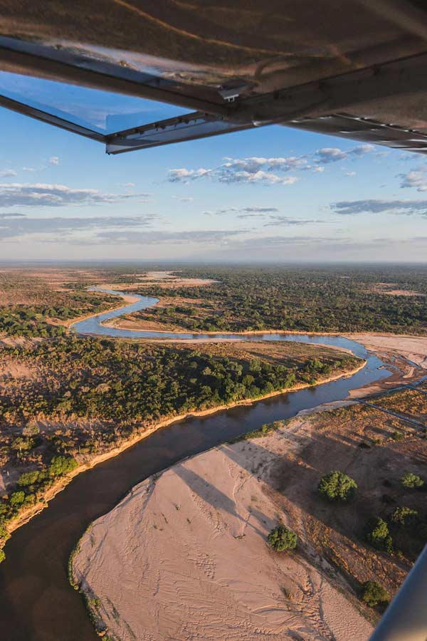
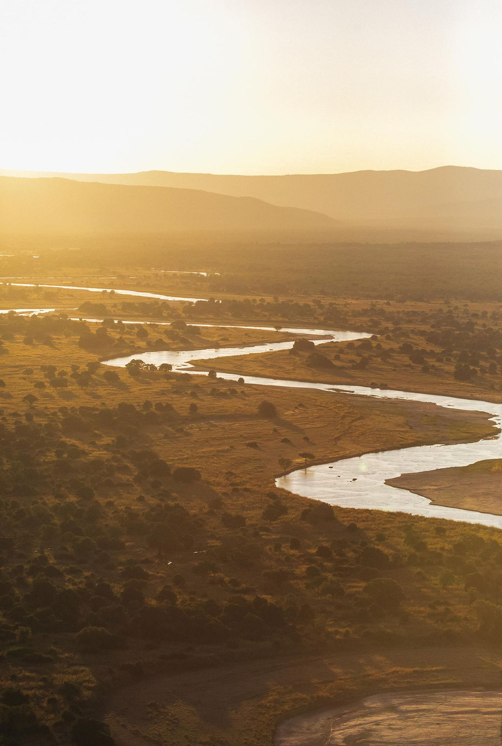
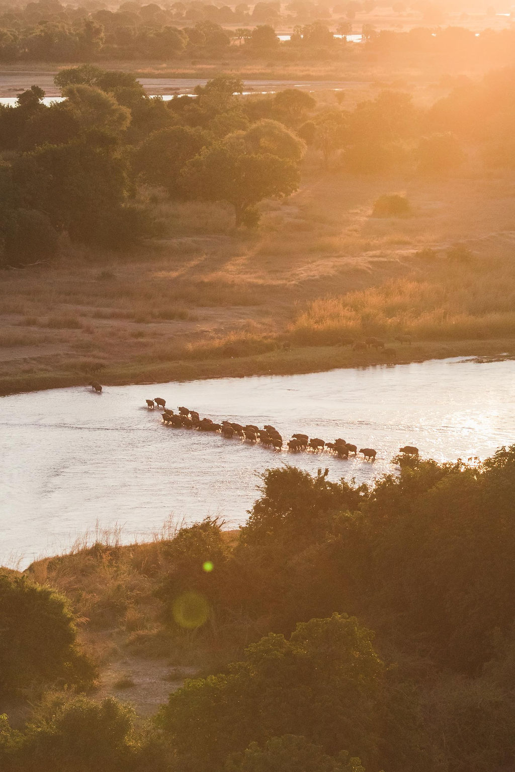
The Luangwa Valley is one of Africa’s prime wildlife sanctuaries, with concentrations and varieties of game and birdlife that have made it world famous. The ‘Valley’ lies at the tail end of the Rift Valley continental fault,which runs from the Red Sea down the length of East Africa to Antarctica. This accounts for the spectacular escarpment scenery in East Africa as well as the African Lakes. As the Rift reaches Zambia, it divides: one arm to the east encompasses Lake Malawi, and the western arm becomes the Luangwa Valley. As an ancient valley it has been worn down through the ravages of time and weather but is no less impressive, stretching some 700km long and an average 100km wide.Bordered by the Muchinga Escarpment in the west and Mafinga mountains in the east, the Luangwa River flows through the valley floor, fed by just six perennial rivers but dozens of seasonal rivers that drain into it during the rainy season. The river carves a winding course and, when in flood, rapidly erodes the outer bends, depositing silt, creating loops, cutting new courses, and ultimately forming ‘ox bow’ lagoons. These lagoons are very important to the ecology of the riverine zone and account for the high wildlife-carrying capacity of the area, giving rise to four National Parks along its banks.
THE ECOSYSTEM
The ecology, wildlife and landscapes of the North and South Luangwa National Parks are virtually identical, but unlike the relatively flat relief of its southerly neighbour, 24% of North Luangwa National Park extends west into the Muchinga escarpment providing a greater diversity of habitats, particularly for birdlife.
The escarpment is home to some more unusual mammals, including occasional sightings of sable antelope, blue duiker and blue monkeys. In the North Luangwa you’re more likely to see Cookson’s wildebeest, one of the Valley’s endemic subspecies. Thornicroft’s giraffes are endemic to the Valley and have been gradually expanding their range north from the south of South Luangwa, although remain occasional visitors.
Four of the six perennial tributaries of the Luangwa river flow within the North Luangwa ecosystem, making this section vital for its course.
NORTH LUANGWA NATIONAL PARK
Declared as a national park in 1972, North Luangwa National Park, known locally as ‘North Park’, covers 4,636km² of the Luangwa Valley. It was officially declared a ‘wilderness area’ with minimum management and even fewer personnel to protect it.
South Park by contrast was managed and protected in an effort to better understand the effects of large elephant populations on habitats. However, this grand scale ‘experiment’ coincided with the rise of poaching throughout the 1970s. North Park suffered and poachers shot and killed indiscriminately, decimating the elephant population and completely wiping out black rhino.
In 1986, the North Luangwa Conservation Programme partnership was created to change the future of North Park. Originally established by Mark and Delia Owens, they were granted permission to set up a research station in the park and soon saw a need for anti-poaching initiatives from local communities. These efforts led to a virtual end to poaching; to an improvement in the lives of local villagers; and a stabilisation of the Park for wildlife, as well as the people living around it.
As wildlife numbers increased, a burgeoning tourism niche began with safari operators bringing limited numbers of visitors into the Park for guided walking safaris and game drives. To this day North Park remains largely untouched, with few roads offering a truer wilderness experience than its larger, busier, sister park in the south.
Nestled to the east by the Luangwa River and to the west by the dramatic Muchinga escarpment, North Park benefits from a number of perennial and seasonal rivers running through the Park and into the Luangwa river, which play an important ecological role in the area. The Lufila and Mwaleshi rivers, both perennial, flow clear in the dry season down the escarpment through a series of gorges and waterfalls to reach the valley floor and feed the Luangwa river.
The Mwaleshi river, running centrally west-east through North Park, is the current focus for tourism with game drives permitted on the north bank; and with no roads or game drives permitted on the south bank, it is a walking safari paradise.
GAME MANAGEMENT AREAS
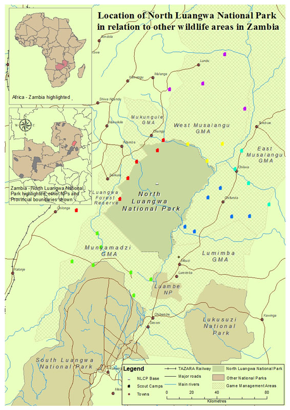
Game Management Areas are buffer zones to national parks where humans and animals can co-exist. North Park has six such protected areas around its periphery: Mukungule GMA, West Musalangu GMA (Fulaza), East Musalangu GMA (Chifunda and Chikwa), Lumimba GMA, Munyamadzi GMA (Luawata and Nyampala) and the Luangwa Forest Reserve. Each area has its own set of restrictions on land and animal use, and the North Luangwa Conservation Programme invests heavily in wildlife and community projects to perpetuate the integrity of the ecosystem and its biodiversity for present and future generations